Showing posts with label Brodick Bay. Show all posts

Friday, January 23, 2015

Big boats and little boats in Brodick Bay.

As we paddled into Brodick Bay in the sunset, we were not alone. A Royal Navy type 23 frigate was exercising in the Firth. She is possibly HMS Somerset who has been involved in tracking a Russian submarine in the approaches to the Firth of Clyde.

 Next we came across two tankers. Askholmen and...

 ...Bro Deliverer. Both were waiting to go up to the terminal at Finnart on Loch Long.

 We slipped unnoticed along the hull of Bro Deliverer from stern past...

 ...midships...

...to her bow. From her anchorage it was only a short distance to the...
 
 Brodick ferry terminal. We did not have long to wait until our ferry home, MV Caledonian Isles, arrived at her berth.

It had been a fantastic winter day during which we had covered 30km and introduced another paddler, Maurice, to paddle sailing. It could not get much better, or colder...or could it?

Thursday, January 15, 2015

Despite the approach of darkness and the ferry, we stopped to savour the view of the mountains.

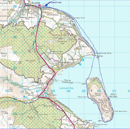
We launched from the sands of Sannox with the hope that we might be able to paddle  sail all the way down the east coast of Arran to Brodick.

 By the time we got to Corrie the sun was setting behind the hills and as it did so...

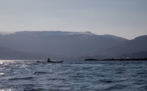
 ...the wind dropped and wood smoke from village stoves hung in the air. The flood, north going tide can make this stretch take longer than planned and we had a ferry to catch!

For a while we paddled in the shade of the North Goatfell ridge and the temperature plummeted. From here we got a good view of the lip of the hanging valley or corrie after which the village of Corrie takes its name.

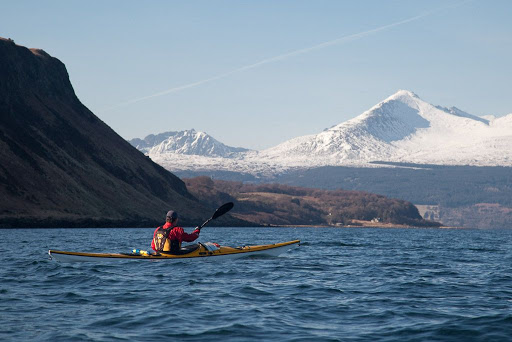
The mountains fell away as we reached Merkland Point, the northern limit of Brodick Bay and the sun reappeared for...

 ...a few precious warming minutes.
 
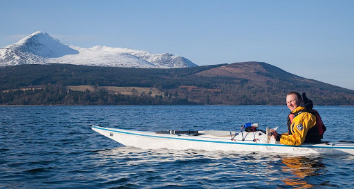
 As we swung round into the openness of the bay...

The soaring south ridge of Goatfell rose above the trees.

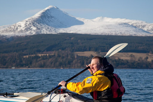
Although we needed to press on to catch the ferry it was...

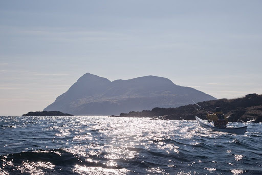
 ...hard to resist the temptation to repeatedly stop, look back and savour the view of snowy mountains that had dominated our day.

Monday, June 11, 2012

The pleasure of weighing anchor in your own backyard.

As we waited at Brodick pier for the ferry back to Ardrossan, there was a change in the air. High cirrus clouds streaked across the sky...

...and at lower level, thick clouds from the NW spilled over the rocky ridges of Arran.
 
The MV Caledonian Isles arrived bang on time and...

...we trollied our kayaks onto the car deck. Before we left Brodick, we were in the cafeteria enjoying chicen patia, rice and nan bread washed down with some Arran Blonde Ale.

We had just not long left Brodick, when the forecast wind suddenly got up with a vengeance. We were very glad we had left Kildonan early that morning. This NW wind also explained the increasing northerly swell we had encountered after leaving Holy Island.

As we approached Ardrossan, the ship's Tannoy announced "Would all drivers and their passengers please return to the car deck." We assumed that this included kayakers.

All too soon we were back in the car park and our Arran adventure was well and truly over.

136km may not sound much as great expeditions go, but for us it was a wonderful escape. It was one of the best holidays we had ever had and all the sweeter as it was in our own backyard. It was also in the land of our ancestors!

Sunday, June 10, 2012

A final downwind blast back to Brodick.

From Clauchlands Point to Corriegills Point  the coastline of Arran is an untamed, road-less wilderness of steep, rocky slopes tumbling to the sea. Buzzards and an eagle soared overhead.

The view of the Arran ridges became very impressive with Beinn Tarsuin 826m, A'Chir 745m and Goatfell 874m, dominating the skyline ahead.

 We had made such fast progress using the sails that...

 ...we nearly made the earlier ferry!

However, we arrived back at a sunny Brodick in plenty time to...

... leisurely pack our things away. What a fantastic trip we had enjoyed in a stunning spell of March weather. We relaxed in the sun and shared the highlights while we awaited the return of the MV Caledonian Isles.

Sunday, November 14, 2010

A dream of the otter and the mountain

Although we were some way offshore, an otter surfaced between Tony and myself, a still wriggling fish clamped firmly in its jaws. Unfortunately it was gone before I got my camera out.

As we approached Brodick Bay...

...we paddled alongside a beautiful mixed woodland.

I had borrowed Tony's new Werner Cyprus paddles. He was very pleased when I finally, and ever so reluctantly, gave them back. He just laughed when I said I would just have to buy some myself!

As we made our way across Brodick Bay, Goatfell rose majestically behind us.

The wind dropped to nothing and we drifted, savouring the moment for as long as we could, not wanting the dream of the day to end. It was now just a short distance to the ferry terminal and a ride back to reality in MV Caledonian Isles. The remarkable thing is that we were only 22km from the Ayrshire coast and home.

Friday, May 28, 2010

A crusade by sea kayak to the Holy Island


A 20km paddle from Brodick on Arran round Holy Island, March 2010.

The north going flood tide enters Lamlash Bay by the South channel and exits by the North Channel the south going ebb tide runs in the reverse direction.

N going flood +0605 HW Greenock -0500 HW Dover, 1knt springs S channel 0.75knt N channel
S going ebb +0040 HW Greenock +0200 HW Dover, 1.5 knt springs S channel 1 knt N channel

Lamlash tidal constant -0025 Greenock +0050 Dover


Destination Holy Island!


The mountains of Arran

No egos at Portencross!

Seeking shelter in Brodick Bay.

Egalitarian cruising on the Clyde

Little and Large in Lamlash Bay.

Do Holy Island monks think they are above the Law of Scotland?

The west coast of Holy Island, Arran

The Inner (and Outer) Light of Holy Island

Tony hangs up his hat on Holy Island

End of a Crusade to Holy Island


Photo album map

Monday, May 24, 2010

She sailed of into the sunset...


We did not have long to get changed and get the kayaks ready as the Arran ferry arrived at Brodick not long after us. We soon boarded and made our way to the dining room.


After a very pleasant evening meal of Calmac chicken curry and chips it was time to return to the kayak deck, ready for disembarkation at Ardrossan on the Ayrshire coast.


We had just loaded the kayaks on the cars in the time it took the MV Caledonian Isles to reload with another set of cars and passengers on their way to Arran.


Then the MV Caledonian Isles...


...sailed off into the sunset...


...which grew deeper by the minute. Our Arran adventure was over.

Sunday, May 23, 2010

End of a Crusade to Holy Island


We left the shady beach on the east coast of Holy Island and paddled towards the north and the sunlight slopes beyond.


Crossing the north entrance to Lamlash Bay we took one last look back at the distinctive outline of Holy Island, the subject of our recent crusade.


Passing low Hamilton Isle, we made our way to the...


...tumbling slopes of Clauchlands Point round which,


Arran's snow covered peaks came into view one after the other.


Reluctant for our paddle to come to an end, we loitered in Brodick Bay as long as we could, as our ferry, the MV Caledonian Isles, steadily increased in size on the eastern horizon.


All too soon our time on the water was coming to an end. None of us knew it then, but this would be the last time that Tony and the second last time that Phil and I would paddle with our good friend Jim.